Lake Simcoe Conservation Preserve
The Lake Simcoe Conservation Preserve is a recent land acquisition by the Conservation Authority. The property is 890 acres of forest, grasslands, active agricultural fields, and extensive wetlands located in the Town of Georgina. Given the property’s size, and the fact that it has not been managed for decades, the Conservation Authority has begun an assessment of its features to determine how to manage it into the future. The name "Lake Simcoe Conservation Preserve" is temporary until a permanent name is selected during the Comprehensive Planning (i.e., long-term planning) process.
Until such time the property has been fully mapped and a Comprehensive Plan created, it is not open to the public. Please respect the no trespassing signs. This is for safety and legal reasons as well as to protect natural features and species that live there.
On this page you can review work carried out to date, and sign up for updates.
-
Public Consultation Complete - Spring 2026
Share Public Consultation Complete - Spring 2026 on Facebook Share Public Consultation Complete - Spring 2026 on X (formerly Twitter) Share Public Consultation Complete - Spring 2026 on Linkedin Email Public Consultation Complete - Spring 2026 link LSRCA staff discuss potential land-use activities for the Preserve at the March Open House.
 Consultation for the Comprehensive Stewardship Planning process is now complete. Over the past months, we connected with the community through public open houses, the 'Have Your Say' platform, presentations to the Town of Georgina Agricultural Advisory Committee, door-to-door conversations with neighbouring properties, social media, and discussions with our Advisory Committee and leadership groups across the organization.
These efforts resulted in approximately 50 open house attendees, 110 survey responses through the Have Your Say platform, and more than 35,000 social media views and engagements.
Using what we heard throughout the process, we’ve redrawn the activities maps to better reflect the community’s wants, needs, and priorities. Thank you for helping shape the future of this space with us.
To learn more about the consultation phase, read our Consultation Summary Report.
To see our redrawn maps, please read our Updated Proposed Activities Maps Report.
Both documents are also listed in the "documents" section on the right.
-
Public Open House
Share Public Open House on Facebook Share Public Open House on X (formerly Twitter) Share Public Open House on Linkedin Email Public Open House link
Join us for an in-person open house to learn more about the project and provide your input
4:30 - 7 pm, Sat February 21st 2026
or
5:30 - 8 pm, Tues March 3rd 2026
Georgina Ice Palace
90 Wexford Drive, Keswick
If you’re unable to make it but still want to Have Your Say, provide your feedback on the draft land stewardship options through our online survey: Take the survey here! -- The survey is now closed. Thank you to those who provided their input.
-
Winter 2026 Activities
Share Winter 2026 Activities on Facebook Share Winter 2026 Activities on X (formerly Twitter) Share Winter 2026 Activities on Linkedin Email Winter 2026 Activities link External Advisory Committee providing input through an in person engagement event.
A second External Advisory Committee was held in January 2026 to review proposed activities, and to hear the thoughts and feedback from the group about what they feel the community and the groups they represent would like to see.
In mid-February, we initiated the public consultation process for the Comprehensive Stewardship Plan. This includes opportunities for online feedback, as well as two in-person open houses. We are looking for feedback from the community to ensure that the Preserve can help meet local wants and needs.
The Public Open Houses are being held in the upstairs Hall at the Georgina Ice Palace (90 Wexford Drive, Keswick), on Saturday February 21st from 4:30 to 7pm and the second is Tuesday March 3rd from 5:30 to 8pm.
-
Fall 2025 Activities
Share Fall 2025 Activities on Facebook Share Fall 2025 Activities on X (formerly Twitter) Share Fall 2025 Activities on Linkedin Email Fall 2025 Activities link Staff and external advisory committee on a site visit in November 2026We’ve officially started drafting the long-term Comprehensive Stewardship Plan for the Lake Simcoe Conservation Preserve! The entire process will take about a year, and the final product will provide implementation, management and maintenance guidance for the next 20 to 25 years.
A Comprehensive Stewardship Plan considers a variety of factors, including: community needs and how the Preserve can meet some of those needs; financial feasibility, including an understanding of the resources required to implement and maintain the recommendations outlined in the plan; and, ensuring natural heritage values, and significant species and spaces are all protected through a two-eyed seeing approach.
Two working groups have been created to help guide this process: an Internal Project Team comprised of Conservation Authority staff; and an Advisory Committee with Municipal, Regional, First Nations, community and sector group representatives, and local community members.
The external Advisory Committee met once in the fall of 2025. They also toured the property to better understand what the lands truly looks and feels like.
-
Spring and Summer 2025 Activities
Share Spring and Summer 2025 Activities on Facebook Share Spring and Summer 2025 Activities on X (formerly Twitter) Share Spring and Summer 2025 Activities on Linkedin Email Spring and Summer 2025 Activities link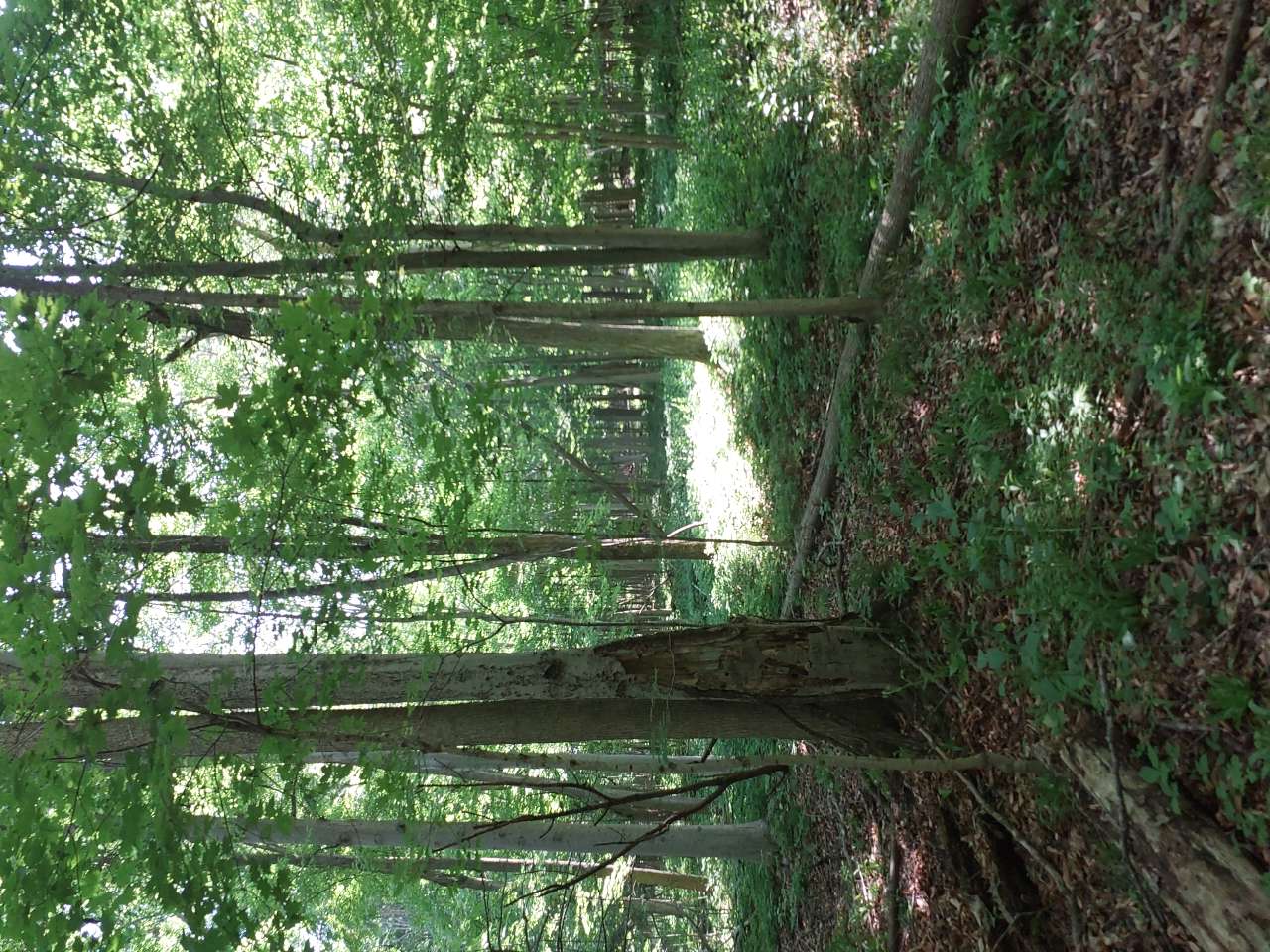 An image of the forest taken by staff during summer forest inventory. The forest inventory that began during the winter was completed this summer. Sites were revisited to collect additional data about groundcover, forest regeneration, and invasive species. In total, the Forestry Team inventoried 143 plots.Ecological monitoring continued on the property, with two acoustic recorders installed on the property in May to July. These units record daily during sunrise for birds and after sunset for bats. These recordings will provide a more in-depth picture of the current species in these areas, which will allow Conservation Authority staff to identify ways to support those species.Monitoring, mapping and control of phragmites (an invasive wetland plant) also continued into the summer of 2025. Monitoring occurred to identify any new patches, and to evaluate the effectiveness of the herbicide application treatments from the fall of 2024. And in good news, staff found that the treated patches were significantly reduced! During that monitoring, however, staff did find some new patches. Those additional patches will be controlled this fall by a licensed contractor to prevent further spread of this highly invasive plant.
 -
Winter 2025 Activities
Share Winter 2025 Activities on Facebook Share Winter 2025 Activities on X (formerly Twitter) Share Winter 2025 Activities on Linkedin Email Winter 2025 Activities link
Over the winter, the Conservation Authority has undergone a tree inventory. We have collected data on tree species, height, health, and invasive plants. There are 162 study areas across the preserve properties, surveying once every 150 metres. We will use this data to understand forest composition, and to inform future management.
So far, we have found lots of poplars, willows, and cedars. We have also found several invasive plants and pests including dog-strangling vine, common buckthorn, and emerald ash borer.
-
Fall 2024 Activities
Share Fall 2024 Activities on Facebook Share Fall 2024 Activities on X (formerly Twitter) Share Fall 2024 Activities on Linkedin Email Fall 2024 Activities link
Indigenous Engagement continues to be led by Cambium Indigenous Professional Services to deepen the Conservation Authority’s understanding of the property from an Indigenous Lens to develop a two-eyed seeing approach. Two-eyed seeing is an approach that challenges people to look at an issue through multiple lenses--in this case, taking both an Indigenous Traditional Ecological Knowledge, as well as a western science-based approach. As part of this process, an Indigenous Knowledge Carrier Council was created and a fall site visit was carried out to better understand the property’s transformations through a different season. The first gathering of the Knowledge Carriers Council took place in November 2024. At this meeting, a plan for how this group will be involved in the engagement process was created. Staff from Cambium and the Conservation Authority review a map on a site visit.
 -
Summer 2024 Activities
Share Summer 2024 Activities on Facebook Share Summer 2024 Activities on X (formerly Twitter) Share Summer 2024 Activities on Linkedin Email Summer 2024 Activities linkidentified and mapped in 2023 were controlled in September 2024 using a foliar application of herbicide. Conservation Authority staff examines a patch of phragmites
Invasive species control efforts were implemented to reduce phragmites on the property. All patches that were
As part of the Conservation Authority’s new watershed wide terrestrial long-term monitoring plot program, a deciduous forest monitoring plot was set up and surveyed on the property. This program aims to determine the current status of and identify long-term trends in the health of our watershed’s forests.
Boundary inspections continued this season, with additional property boundaries being followed to find iron survey bars and to look for any encroachment or other issues.
Progress towards a Traditional Knowledge report and the Land Relationship Visioning exercise continued, guided by the project Cambium Indigenous Professional Services, and included Indigenous community engagements and a summer site visit.
-
Winter and Spring 2024 Activities
Share Winter and Spring 2024 Activities on Facebook Share Winter and Spring 2024 Activities on X (formerly Twitter) Share Winter and Spring 2024 Activities on Linkedin Email Winter and Spring 2024 Activities link A spring view of the conservation preserve.
Retained an Indigenous Consulting firm, Cambium Indigenous Professional Services, to walk us through a Land Relation Visioning exercise that will result in a Traditional Ecological Knowledge Report, that will feed directly into the creation of the Comprehensive Plan. Boundary inspections continued to occur on sections of the property which had not yet been inventoried by Authority staff.
-
Summer and Fall 2023 Activities
Share Summer and Fall 2023 Activities on Facebook Share Summer and Fall 2023 Activities on X (formerly Twitter) Share Summer and Fall 2023 Activities on Linkedin Email Summer and Fall 2023 Activities link Flowers in bloom found on the Preserve.
Continued installing fencing and gates in the areas where they were needed to protect the property from unsanctioned access.
Conservation Authority staff conducted a three-season botanical inventory to add to our knowledge of the plant species present on the Preserve properties. This included finding a number of regionally rare and sensitive species.
A Contractor was hired to conduct a thorough invasive species inventory on the lands to monitoring the species, spread and density of terrestrial invasive plants on the lands. This information guides Conservation Authority staff in how to proceed with property management and provides insight into priority control areas and management activities.
Who's Listening
-

Email L.Curran@lsrca.on.ca
